Best offline maps for travelling in Nepal
Travelling takes the stress out of the repetitive, mundane life. But switching off to a thought of a week off work isn’t as easy as it seems. But honestly, everyone should make time to break from the usual thought process. Nepal is one of the less explored countries with magnificent nature and rugged landscapes. Most of the splendid natural locations are still calming and unaffected by waves of tourists. The tranquility of the green spaces and the waves of the Himalayas in Nepal sets your mind back to the peaceful rhythm. But this also makes it hard to explore unless you are Bear Grylls with a TV crew to help you.
Conquering the unforgiving geography and remoteness can be rewarding. But unless you have the survival skills or an experienced local guide, you are not going to enjoy getting lost. If you are like most travelers, you’ll likely have a smartphone with a good GPS to navigate. Although GPS is great, having roads, trails, whereabouts, and points of interest are vital. If you are traveling in Nepal, this could be as essential as carrying a gas mask on the streets of Kathmandu.
Google Maps
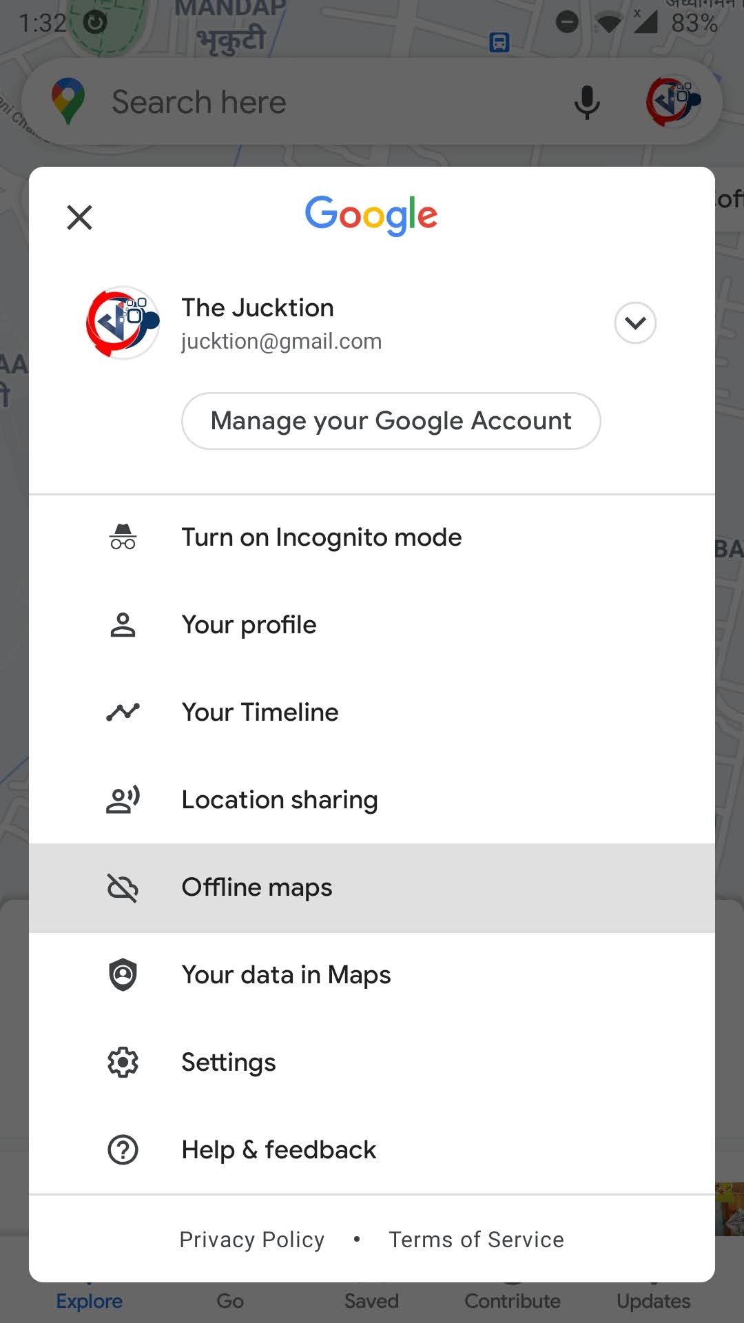
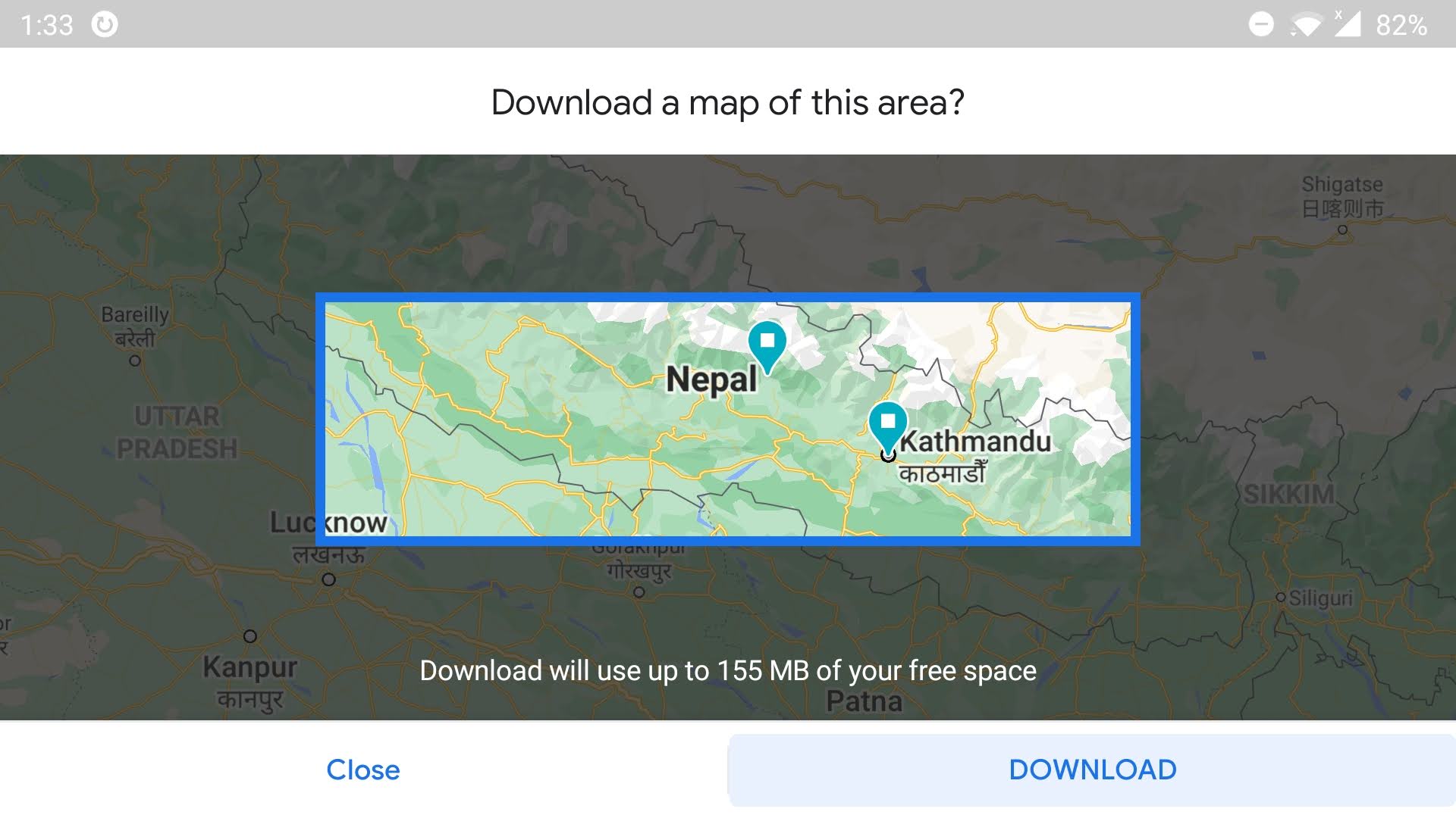
Google Maps now allows you to download an offline map for Nepal. Google Maps should provide you with more detailed geographical data than other alternatives. You can download map data with offline maps feature on Google Maps. Offline maps lets you pick a rectangle view of an area in portrait and landscape mode. The rectangle, however, is not editable and you will most likely need more than a few sections to include all of Nepal. Offline map will contain the default maps view, and not contain satellite data.

OpenStreetMap Alternatives
Most other offline map apps use OpenStreetMap (OSM) data. This means the pathways are mostly the same depending on the last map update. However, it’s the execution of an app with simplicity, feature, and accessibility that matter the most. We tried Citymaps2Go, Maps.me, All-In-One Offline Maps, and Maps & GPS Navigation OsmAnd, We used free versions of the applications.
Our usage of these apps for same destinations in Nepal show quite a bit of difference in satisfying the requirement. While city guides from Citymaps2go and multi-layered maps of All-In-One Offline Maps were appealing. They were not perfect unless you are using Citymaps2go for navigating popular city areas or analyzing geography with All-In-One Offline Maps. For us maps.me provided a better objects, buildings, routing, bookmarks, and interface.
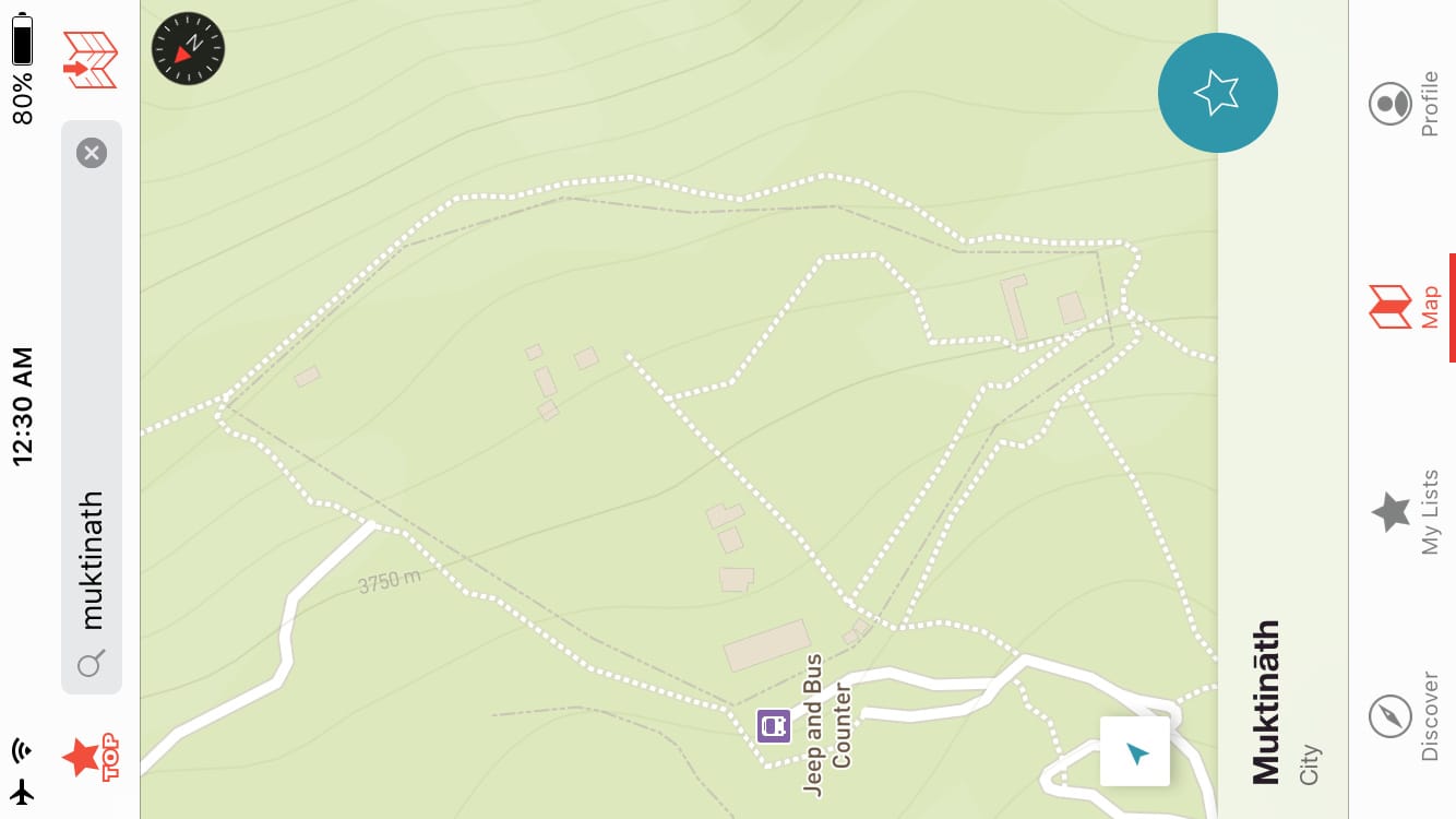
Maps.me was once a paid offline mapping service. But their acquisition by Mail.ru opened up the app for everyone as a free app. Even if you look at the reviews on the Google Play Store, they’ve got 4.5 rating with 755,212 votes while second place Citymaps2go has 4.3 rating with 55,463 votes. With the usage of a huge number of people and data sharing with the community, it has indeed proven itself the better alternative.
For Nepal, during our visit to different cities, and even remote trails, it had more informative data than the rest. It obviously does not have traffic data of roads in Nepal as we don’t think anyone is tracking the data. Here is what we believe that you will be benefiting with these features:
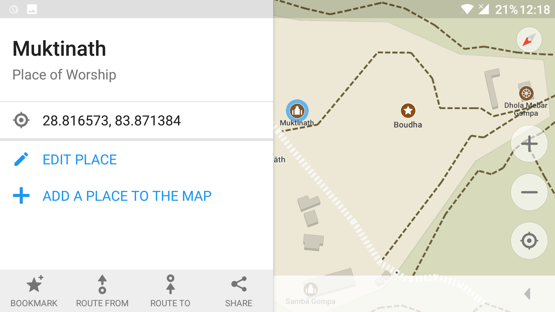
- Offline map with most point of interest destinations
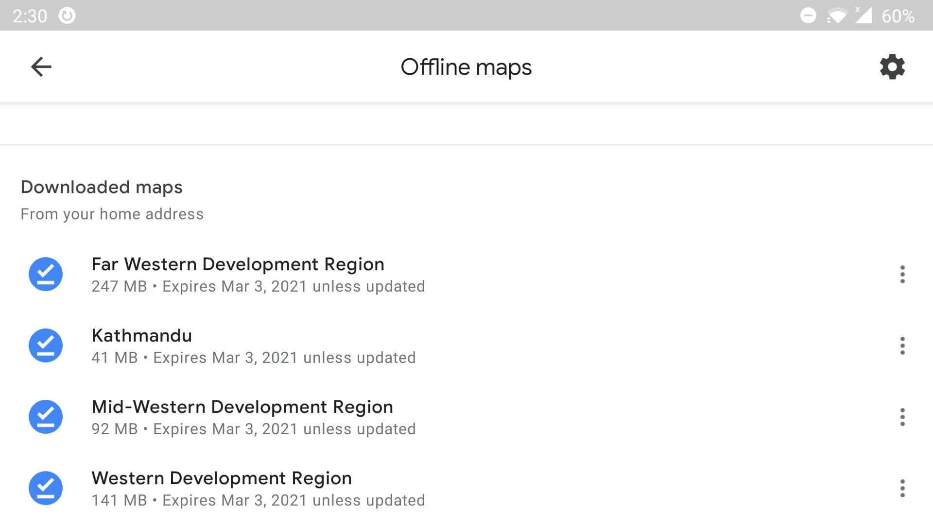
- Download the maps in parts, without wasting a lot of space. (West, Eastern Region, Central Region, and Kathmandu)
- Night mode for strain free viewing for nights. Also power cuts are random and irritating.
- Find routes for driving, biking or hiking trails with expected arrival time calculations
- Bookmark your favorite locations into the app.
- Share your locations with friends, other apps, and social media
- Backup and restore your bookmarks when moving to a new phone
- OpenStreetMap account integration
- Turn by Turn navigation for driving
However, this is based on our experience across a number of locations not at extreme distances from well-known trails or roads. However, if you want to take a walk into the wild, with this app, clear skies, and enough battery to last, we are pretty sure you will find your way back to the hotel for a good night sleep. Unless, of course, the wild gets you first.